
Hill 70
The key to Lens
Situated three kilometres north of the town of Lens along the main road towards La Bassée the position takes its name from the contour line at its crest but in fact this gently sloping ridge only dominates the surrounding plains by about ten metres.

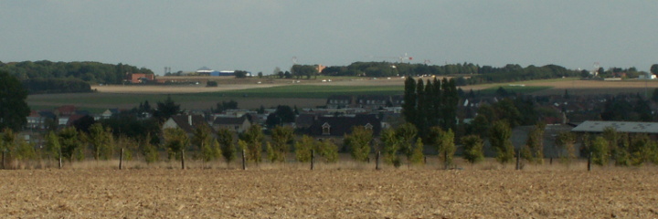
From Loos village looking towards Hill 70.
The red brick building on the left of the hill is the Crematorium in front of Bois Rasé.
The hospital sits on the summit of the hill.
Looking at the hill today populated with its buildings and commercial centres it is hard to think of it as a barren slope riddled with trenches dug into its chalk.
For a few hours in September 1915 the hill had been in Scottish hands during the Battle of Loos but a lack of reserves had forced the British to relinquish their conquest (Lieutenant John Kipling, the only son of the British author Rudyard Kipling was killed during the battle).
Be aware for your GPS that the full name of the town is Loos-en-Gohelle (The town of Loos is near Lille). The name is pronounced more like Loss than Loose.
In the intervening two years the Germans had fortified the position but held it only lightly in accordance with their new policy of defence in depth. On the Somme, in 1916, German casualties had been as horrendous as those of the British due to the doctrine of holding on to every metre of ground filling the trenches with troops who were vulnerable to shelling.
The new system allowed some flexibility at the front. Any losses would be dealt with by trained reserve units (Eingreif) held further back.
Lt General Sir Arthur Currie intended to use this against the Germans. The Canadian Corps would storm the hill and advance to the German second line on the eastern side — and stop! Their own artillery observers would then position themselves on top of the ridge and await the inevitable counter attack.
The main assault was to be carried out by the 1st and 2nd Canadian Divisions whilst the 4th Canadian Division mounted a diversionary operation to the south of the town, opposite Avion.
The two assaulting Divisions employed two Brigades in the attack. From north to south these were the 3rd and 2nd Brigades of 1st Division responsible for capturing Bois Hugo on the left flank and Hill 70 itself. The 5th and 4th Brigades of 2nd Division would attack to the south of the hill through the Cité St Edouard, Cité St Emile and Cité Ste Elizabeth.
The mining companies were responsible for housing their workers. This gave rise to the various Cités; often named after the colliery around which they were based. In 1917 these clusters of houses were not considered as part of Lens. Driving the area today you will still see signs for some of these Cités. During the intervening years the urbanisation of Lens-Liévin has filled in the gaps giving a false impression of the ground.
On the battle maps there were two main objectives: the Blue Line running through the German positions along the crest of Hill 70 and the Green Line about 1500 metres from the Allied front line. The Green Line marked the Germans’ second position and ran around the eastern base of the hill.
The intention was that the assaulting troops would pause at the Blue Line whilst the artillery realigned their guns to take the infantry on to the Green Line. As the soldiers of the 2nd Brigade had the furthest distance to cover they also had an intermediary Red Line.
