


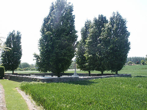
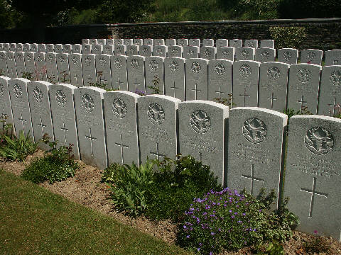
Guémappe British Cemetery
Location
Wancourt is a village about 8 kilometres south-east of Arras, and Guémappe British Cemetery is about 1 kilometre north-east of the village, to the south of the junction of the roads to Monchy-le-Preux and Guémappe (D34).
Come out of Arras on the N39 / D 939. At Monchy-le-Preux you will see Windmill Cemetery on your left and the panel for the Newfoundland Monument (In the village on your left). Turn RIGHT following the wee CWGC signs and this will lead you down past Tank Cemetery to Guémappe British Cemetery.
| GPS | N | E | OSM |
|---|---|---|---|
| Decimal | 50.251873 | 2.878236 | Map |
Historical Information
Guémappe was captured by Commonwealth troops on 23rd and 24th April 1917, twelve days after Wancourt. It was lost on 23rd March 1918 and retaken by the Canadian Corps on the following 26th August.
Guémappe British Cemetery was begun by the 15th (Scottish) Division after the capture of Guémappe, and used by fighting units until January 1918. It was severely damaged by shell-fire in 1918.
The cemetery contains 169 burials of the First World War, six of them unidentified.

Serjeant Major John Campbell S/2934
8th Bn Seaforth Highlanders
Died on 23rd April 1917 aged 25
Son of John and Mary Campbell
of 77 Port St Stirling
Husband of Dorothy Pettit
of 33 Eastdown Park, Lewisham, London
Grave: I D 23